Forests
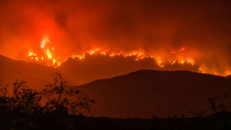
The Age of Firestorms
Dr. Roslyn Prinsley never imagined that stepping outside her home in Canberra would feel like walking into a smoke-filled abyss. But during Australia’s devastating bushfire season in 2019-2020, even in places untouched by flames, the air was so thick with smoke that breathing felt impossible.
“I asked myself, what are we doing here in the 21st century? We can’t actually go outside and breathe fresh air in one of the cleanest countries in the world,” she remembers thinking. “We can’t let this keep going.”
Dr. Roslyn Prinsley is the Head of Disaster Solutions at the Australian National University’s Institute for Climate, Energy & Disaster Solutions (ICEDS). Finding innovative ways to fight wildfires is part of her daily work – a task that has become more urgent than ever as wildfires grow increasingly frequent in Australia and across the globe due to climate change.
Wildfires are projected to rise 30% by the end of 2050, according to a report by the UN Environment Programme (UNEP) and its partner GRID-Arendal.
One of the recent wildfires in California became the most destructive in Los Angeles history, killing at least 29 people—a number expected to rise—and reducing over 10,000 homes to ash. A perfect set of environmental factors such as long-term drought, preceding heavy rainfall, and hurricane-force Santa Ana winds combined at the worst possible moment.
All of this turned the regular wildfire into what’s called a firestorm.
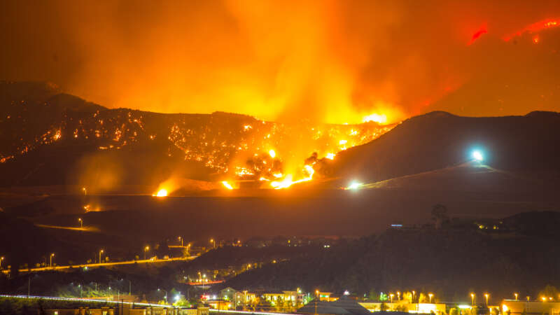
Inside the L.A. Firestorm
The 2025 LA Wildfires were among the most destructive and costly in U.S. history, driven by a combination of shifting climate patterns and growing development in fire-prone areas. As these types of fires become more common, it raises important questions about how we prepare for and respond to future risks. In this PBS video, experts explore the factors behind the firestorm and what can be done to reduce the impact of similar events going forward.
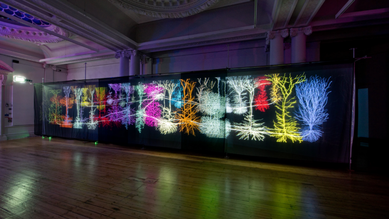
Andrew Carnie: Immersing Audiences in Science
Andrew Carnie is a notable contemporary visual artist with a global exhibition footprint, based in the UK.
An emeritus fellow at the Winchester School of Art, Southampton University, Carnie’s work focuses greatly on the intersection of art and science. In fact, he has a blog focused on just that.
While he frequently collaborates with scientists, his creative approach remains broad and unconstrained by specific media, adapting his methodologies to the context and themes of each project.
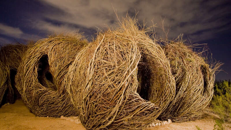
Patrick Dougherty: Rooted in Nature
Patrick Dougherty’s art career is rooted in his fascination with nature and primitive building techniques.
Born in Oklahoma in 1945 and raised in North Carolina, Dougherty first pursued traditional academics, earning degrees in English and Health Administration. However, his return to North Carolina to study art history and sculpture sparked a desire to create works of art utilizing natural materials, particularly tree saplings. Combining this desire with his carpentry skills, Dougherty began crafting unique, large-scale sculptures that organically blend into their environments.
Jacques Régnière: Budworm to BioSIM
Jacques Régnière, born in Quebec City, has dedicated over four decades to advancing our understanding of forest pests and protecting our global forests. Earning his bachelor’s degree in biology from Laval University and a Ph.D. in insect ecology and biomathematics from North Carolina State University, Régnière began his career at the Canadian Forest Service in 1980, where he served until his retirement in 2024.
Throughout his distinguished career, Régnière focused on pressing issues in forest ecology, notably the population dynamics of the spruce budworm, mountain pine beetle, and spongy moth. His work in quantitative ecology has influenced pest management practices and provided a better understanding of climate change’s impact on invasive species and forest health.
Purdue launches new AI-based global forest mapping project
Purdue University’s Jingjing Liang has received a two-year, $870,000 grant from the World Resources Institute to map global forest carbon accumulation rates.
“To accurately capture the carbon accumulation rates of forested ecosystems across the world has always been a challenging task, mostly because doing so requires lots of ground-sourced data, and currently such data are very limited to the scientific community,” said Liang, an associate professor of quantitative forest ecology and co-director of the Forest Advanced Computing and Artificial Intelligence Lab.
“This task is considerably more challenging than mapping carbon emissions from forest loss,” said Nancy Harris, research director of the Land & Carbon Lab at the World Resources Institute, a nonprofit research organization based in Washington, D.C. “With emissions, there’s a clear signal in satellite imagery when trees are cut, leading to a big drop in forest carbon stocks and a relatively abrupt pulse of emissions to the atmosphere. With sequestration, forests accumulate carbon gradually and nonlinearly.”
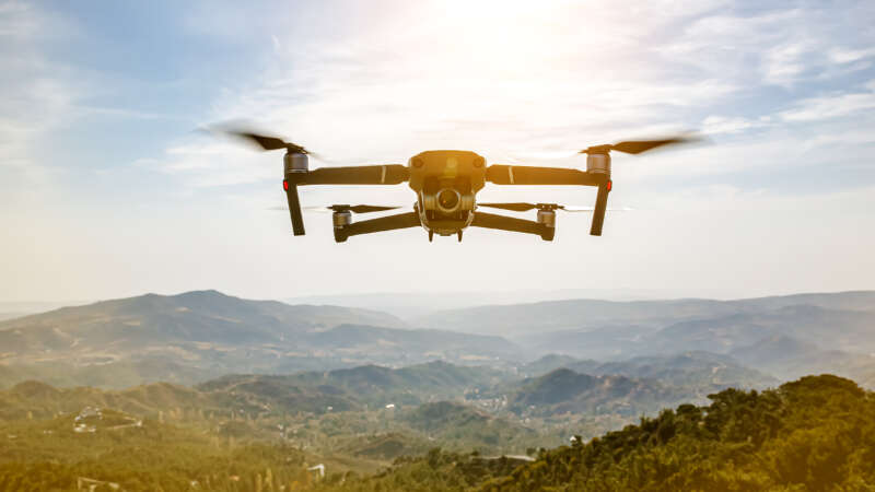
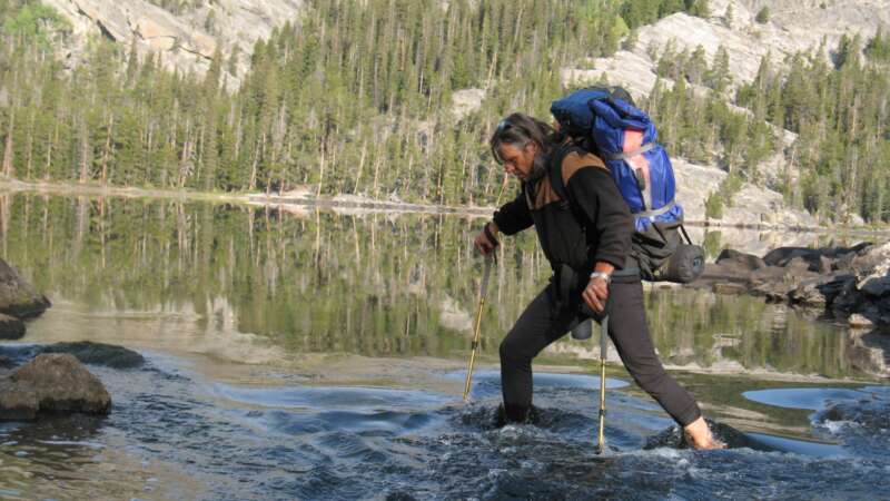
The Role of Technology in Forest Management
In Brazil’s Pará region, new roads are cutting through the pristine Amazon rainforest, opening up once-untouched areas to human activities. Expansive stretches of lush greenery are vanishing at an alarming pace, yielding to barren patches and freshly cleared land.
Meanwhile, far into space, the European Space Agency captures high-resolution satellite images of the region that unveil an important pattern: deforestation occurs predominantly near these newly constructed roads.
Back in 2016, it sparked a question: what if there were a tool to monitor these roads and forecast potential deforestation areas? Not long after PrevisIA was born.
In 2021, Microsoft with Vale Fund and the Amazon Institute for Man and the Environment (Imazon) developed a new AI tool called PrevisIA, to predict deforestation hotspots in the Amazon. Using satellite imagery from the European Space Agency and an algorithm developed by Imazon, the tool produces heat maps showing the most exposed conservation areas, Indigenous lands, and other settlements, along with rankings for states and municipalities.
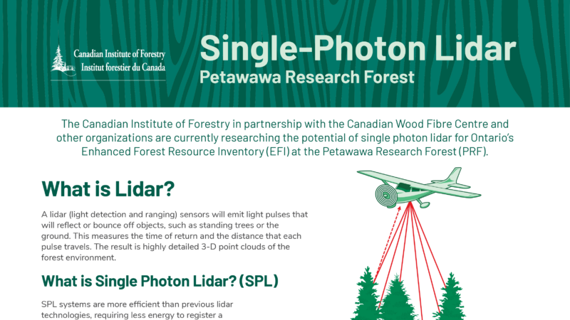
Single-Photon Lidar
The Canadian Institute of Forestry in partnership with the Canadian Wood Fibre Centre and other organizations are currently researching the potential of single photon lidar for Ontario’s
Enhanced Forest Resource Inventory (EFI) at the Petawawa Research Forest (PRF).
What is Lidar?
A lidar (light detection and ranging) sensors will emit light pulses that will reflect or bounce off objects, such as standing trees or the ground. This measures the time of return and the distance that each pulse travels. The result is highly detailed 3-D point clouds of the forest environment.
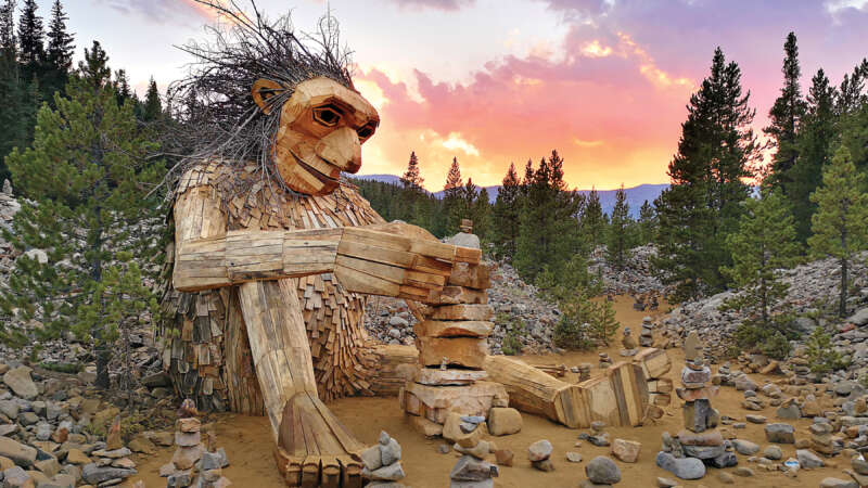
Thomas Dambo: The Master of Upcycled Urban Sculptures
Thomas Dambo, born in Odense, Denmark in 1979, grew up in a creative and communal environment. From a young age, Dambo was encouraged to explore his creativity, building his first wooden box for his brother’s pacifier and scavenging materials to construct massive fortresses with his friends.
As a teenager, Dambo delved into street art, urban exploration, and graffiti. His passion for urban culture and hip-hop led him to become a beatboxer, touring with Norwegian rapper Skranglebein. In 2004, he formed the hip-hop super crew Fler Farver with his younger brother and friends, releasing nine albums and gaining significant recognition in the Danish underground hip-hop scene.
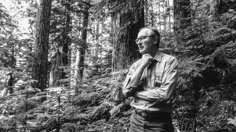
Jerry Franklin: The Father of New Forestry
Jerry Franklin, known as the “Father of New Forestry,” has made his mark in forest management for integrating ecological and economic objectives. His approaches, which faced skepticism initially, have become the standard in both environmental and timber industry circles.
Franklin began his career as a research forester for the USDA Forest Service in 1959. His early work included long-term experiments on forest ecosystems, particularly old-growth forests.